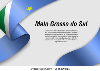
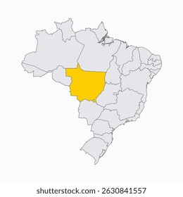
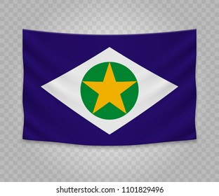
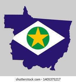
<iframe src="https://www.googletagmanager.com/ns.html?id=GTM-W3R8R6G&gtm_auth=AU1ugrxhJK_EQcp9wg5qxA&gtm_preview=env-1&gtm_cookies_win=x" height="0" width="0" style="display:none;visibility:hidden"></iframe>

136 grosso PNG und SVG Grafikdesigns

Downloade grosso PNG & SVG Designs mit transparentem Hintergrund für T-Shirts, Buchcovers, Handyhüllen und andere Artikel.

Sortieren nach

Am wichtigsten
Bundesstaaten Brasilien - Vektorillustration mit Symbolcharakter
Cartoon map with flag of the brazilian state of Mato Grosso do Sul
Rainbow-farbene Mosaik-Vektorkarte des Mato Grosso-Zustands für LGBT und schwarze Version. Geographische Mosaikkarte des Mato Grosso-Staates ist aus verstreuten Kreispunkten kombiniert.
Symbol Map of the State Mato Grosso (Brazil) showing the territory with a pattern of black circles
Mato Grosso Flag Set, State of Brazil.
Para, a state in Brazil, gray political map, with capital Belem. Traversed by Amazon River, bordering Guyana, Suriname, and the states of Amapa, Maranhao, Tocantins, Mato Grosso, Amazonas and Roraima.
Geometrische Darstellung der Staaten der mittleren und westlichen Region Brasiliens
Mato Grosso Region hervorgehoben auf Brasilien Karte
Mato Grosso do Sul Flag Set, State of Brazil.
Lage von Mato Grosso do Sul auf Karte Brasilien. 3d Mato Grosso do Sul Ortszeichen ähnlich der Flagge von Piaui. Qualitätskarte mit Regionen Brasiliens. Bundesrepublik Brasilien. EPS
Waving Band oder Banner mit der Flagge von Mato Grosso. Bundesstaat Brasilien. Vorlage für Plakatdesign
Waving ribbon or banner with flag of Mato Grosso do Sul. State of Brazil. Template for poster design
Mato Grosso (Region of Brazil, Federated state, Federative Republic of Brazil) map vector illustration, scribble sketch Mato Grosso map
Para, a state in Brazil, political map, with capital Belem. Traversed by the Amazon River, bordering Guyana, Suriname, and the states of Amapa, Maranhao, Tocantins, Mato Grosso, Amazonas and Roraima.
Karte von Mato Grosso do Sul ist ein Staat Brasilien mit Flagge. Vektorgrafik
Mato Grosso do Sul state flag on dark background. Symbol of Brazilian heritage.
Map icon of the brazilian state of Mato Grosso do Sul
Vector Map of Mato Grosso do Sul State with name. Map of Mato Grosso do Sul State is isolated on a white background. Simple flat geographic map.
Symbol Map of the region Mato Grosso Do Sul (Brazil) showing the territory with just a few black horizontal lines
High Quality map of Mato Grosso is a state of Brazil, with borders of the municipalities
Map of Mato Grosso is a state of Brazil with flag. Vector Illustration
Gold square pattern and solid map of Mato Grosso State. Vector geographic map of Mato Grosso State in yellow golden color tones. Abstract mosaic is constructed from randomized flat square points.
Karte von Brasilien unterteilt in einzelne Staaten. Hervorragender Zustand von Mato Grosso do Sul.
Realistic hanging flag of Mato Grosso. State of Brazil. Empty  fabric banner illustration design.
Mato Grosso do Sul (Region of Brazil, Federated state, Federative Republic of Brazil) map vector illustration, scribble sketch Mato Grosso do Sul map
Flagge von Mato Grosso, Pinselstrich Hintergrund.  Flaggenstaat Mato Grosso von Brasilien auf weißem Hintergrund. Aquarellstil für Ihr Design, App, UI.  EPS10.
Map of the Brazilian State of Mato Grosso do Sul with Campo Grande as the Center, Circular Spiral pattern.
mato grosso do sul state flag, state of Brazil. Flag icon. Standard color. Vector illustration.
Geometric map of the brazilian state of Mato Grosso
mato grosso administrative and political map with flag
Mato Grosso (Region of Brazil, Federated state, Federative Republic of Brazil) map vector illustration, scribble sketch Mato Grosso map
Symbol Map of the region Mato Grosso (Brazil) showing the territory with just a few black horizontal lines
Graue Karte des Bundesstaates Mato Grosso do Sul einzeln auf weißem Hintergrund. Vektorgrafik
Mato Grosso do Sul (Region of Brazil, Federated state, Federative Republic of Brazil) map vector illustration, scribble sketch Mato Grosso do Sul map
Schwarze Karte des Bundesstaates Mato Grosso do Sul einzeln auf weißem Hintergrund. Vektorgrafik
Map of Mato Grosso
Map of the Brazilian State of Mato Grosso do Sul with Campo Grande as the Center, Circular Spiral pattern.
Leere Karte des Bundesstaates Mato Grosso do Sul einzeln auf weißem Hintergrund. Vektorgrafik
Mato Grosso do Sul state leere Gliederungskarte
Flagge von Mato Grosso State of Brazil. Bandeira-Beamter. Vektorgrafik
mato grosso do sul administrative and political map with flag
Landkarte des Bundesstaates Mato Grosso do Sul mit offizieller Flagge, einzeln auf weißem Hintergrund. Vektorgrafik
Karte von Mato Grosso
Mato Grossos Flagge repräsentiert seine reiche Kulturgeschichte und natürliche Schönheit. Diese autonome Gemeinde im Mittleren Westen Brasiliens ist bekannt für den Amazonas-Regenwald und das Pantanal-Feuchtgebiet
Ecke schräge Band Fahne von Mato Grosso für einen oberen rechten Bereich einer Seite.
Map - Mato Grosso (Brazil) - 3D-Illustration
Waving flag of Mato Grosso states,federal district of Brazil isolated on gray background
Mato Grosso state blank map set
Flag of Bandeira de Mato Grosso
Brasilien Alle Staaten Flaggen Vektorgrafik in offiziellen Farben und Proportion. Brasilien hat Flaggensammlung.
Gesponserte Ergebnisse von Shutterstock Logo
Erhalten Sie 15% Rabatt mit dem Code: VEXELS15
Illustration of a man with magnifying glass

Wir konnten keine grosso PNGs For Merch, Grafiken finden. Hier sind unsere grosso Designs oder fordere alternativ dein Wunschdesign hier an!

von 3